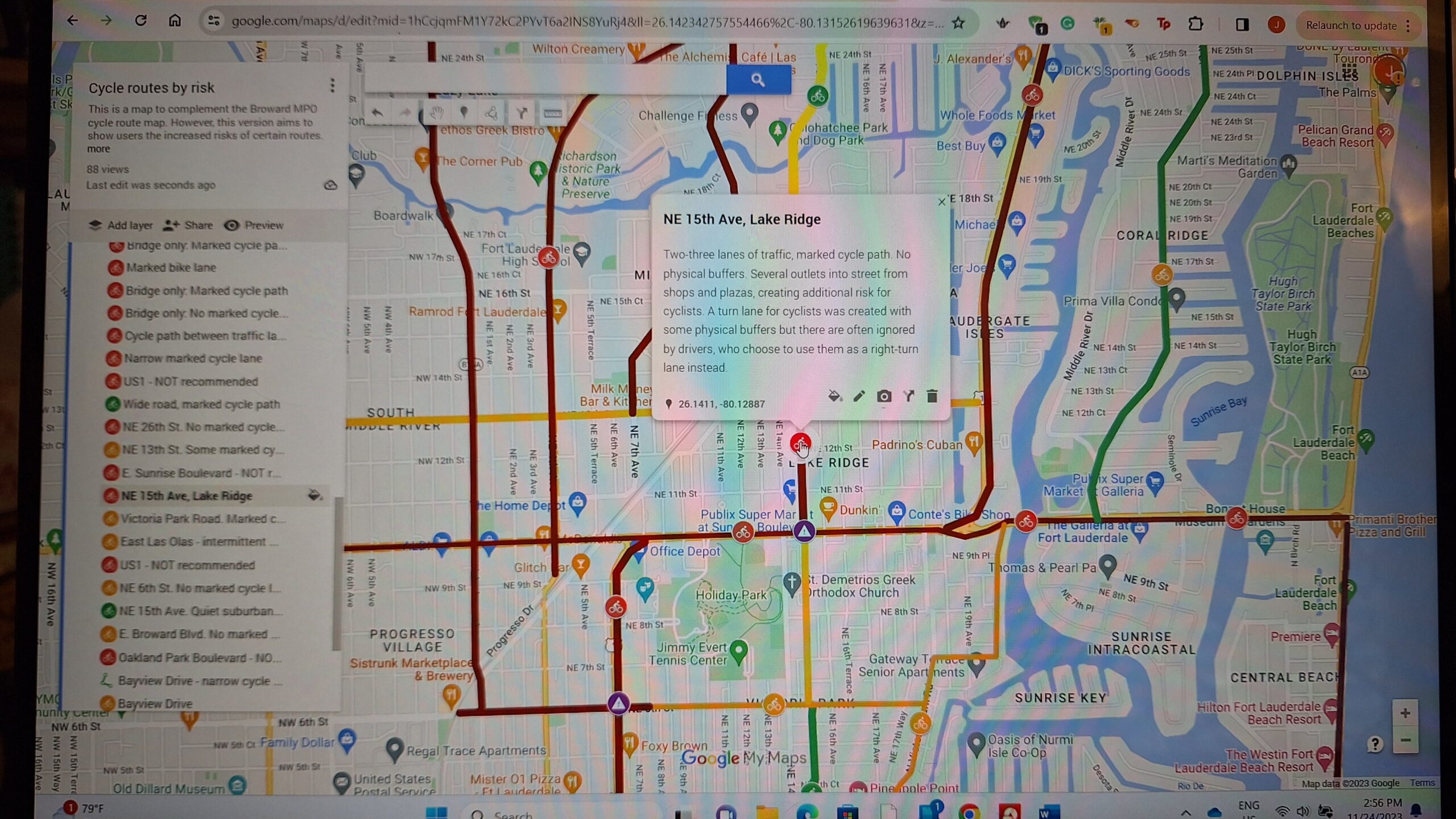
Image showing my interactive community cycle map:

Link to my interactive community cycle map: https://www.google.com/maps/d/edit?mid=1hCcjqmFM1Y72kC2PYvT6a2INS8YuRj4&ll=26.14290603730687%2C-80.13435539414294&z=15
- Maker: Joanna Iovino-Sutherland
- Genre: Maps
- Level: Graduate
- Program: Composition, Rhetoric, and Digital Media
- Course: WRIT 5400: Technical Writing
- Instructor: Dr. Eric Mason
- Semester Created: Fall 2023
Introduction
Fort Lauderdale is flat, with wide streets, and year-round sunshine – a cyclists’ paradise, right? Wrong. As a keen cyclist with nine years’ experience riding these streets, I know that the provision for cyclist safety is very limited, and even though improvements have been attempted, these are not wide-ranging enough and not joined up to other routes. Moreover, a county cycling map has been created and published by Broward Metropolitan Planning Organization which, from my experience, incorrectly classifies routes by level of difficulty, whereas it would be more accurate to classify by risk.
Why it matters
Fort Lauderdale is the county seat of the most dangerous county for cyclists in the state which has the highest level of cyclist mortality in the whole of the US. The more information cyclists have, the safer their journeys can be. Additionally, collating qualitative data about cyclist experiences in Fort Lauderdale can then become a tool for advocacy in increasing cycle infrastructure and safety in the city and surrounding area. Access to safe cycling routes improves equity in access to education and employment, as bikes are inexpensive to own and run, and can be as fast as a car on short journeys. Cycling is also a good form of daily, low-impact exercise available to all abilities and ages, and can be a part of improving mental health through activity.
Reflection
By creating this map, I’ve come to realize how little attention is paid to the needs of cyclists by Broward County. There are cycle lanes – but these are rarely at or above the legal minimum width; there are two locations with physical buffers – but these have been run into by cars and neither repaired nor replaced; there is a cyclist map – but this is inaccurate and misleading. As a growing city in a high-density county, Fort Lauderdale and Broward should embrace the opportunity to become a cycle-friendly city by providing appropriate infrastructure to create a safer, linked-up experience.
Click here to read the full report: http://scmaker.site/CRDM/wp-content/uploads/2023/11/Mapping-as-Rhetoric-1.docx
Sources:
https://www.local10.com/news/local/2022/09/21/florida-leads-the-nation-in-bicycle-related-deaths/


